
Many of the Greek ideas for representing a spherical Earth in a flat map were lost during the Middle Ages. John Short explains that, in the fifteenth century, "the value of sea charts rivaled gold as a primary target for buccaneer captains. Later, maps became status symbols among wealthy merchants who built vast fortunes thanks to thriving trade routes made possible by reliable sea navigation. "
One of the most famous map projections in history is the mercator map (1569), which became commonly used for nautical voyages and is named after Flemish cartographer Gerardus Mercator. Norman Thrower writes, "Like Several other projections, the Mercator is conformal (shapes around a point are correct), but it also has a unique property: straight lines are rhumb lines or loxodromes (lines of constant compass bearing)."
The use of the Mercator map increased in the 1700s, after the invention of the accurate marine chronometer, a timekeeping device used to determine longitude by means of celestial navigation. The mercator map does have imperfections; for example, it exaggerates the size of areas far from the equator.
The Value of Sea Charts Rivaled Gold
The Value of Sea Charts Rivaled Gold

Re: The Value of Sea Charts Rivaled Gold
He who owns a map, owns the world.
“Integrity has no need of rules.”
-Albert Camus
-Albert Camus

Re: The Value of Sea Charts Rivaled Gold
Maps, I have always liked them and collected a few.
Re: The Value of Sea Charts Rivaled Gold
Let's build a fucking ship.
Re: The Value of Sea Charts Rivaled Gold
Haha. I love maps too.
Geo maps, political maps, earthquake maps, ocean current maps...
_________
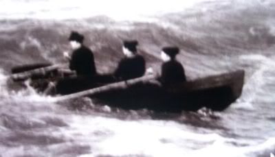
A currach boat! Like Saint Brendan.
Geo maps, political maps, earthquake maps, ocean current maps...
_________
A currach boat! Like Saint Brendan.
“Integrity has no need of rules.”
-Albert Camus
-Albert Camus
Re: The Value of Sea Charts Rivaled Gold
Is it the same as a curragh?
Re: The Value of Sea Charts Rivaled Gold
Yes, it's the same for the most part. Different locals had different variations/styles.
Saint Brendan's voyage was based on a sixth century (?) tale of a monk, St. Brendan, who left Ireland on a currach and had a fantastic voyage encountering islands of crystals, islands that moved and so on. It was theorized that he actually made it across the atlantic ocean to NewfoundLand via Iceland and Greenland (hence crystal islands = icebergs, moving islands = whales) and there have been a couple of re-enactments of this voyage using the currach which is what would have been available and used by Brendan at the time.
Saint Brendan's voyage was based on a sixth century (?) tale of a monk, St. Brendan, who left Ireland on a currach and had a fantastic voyage encountering islands of crystals, islands that moved and so on. It was theorized that he actually made it across the atlantic ocean to NewfoundLand via Iceland and Greenland (hence crystal islands = icebergs, moving islands = whales) and there have been a couple of re-enactments of this voyage using the currach which is what would have been available and used by Brendan at the time.
“Integrity has no need of rules.”
-Albert Camus
-Albert Camus
Re: The Value of Sea Charts Rivaled Gold
Capsulize the boat, throw in some snorkels, and we have ourselves a submarine.