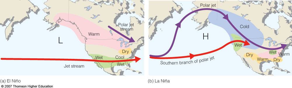
May 19, 2014: Every ten days, the NASA/French Space Agency Jason-2 satellite maps all the world's oceans, monitoring changes in sea surface height, a measure of heat in the upper layers of the water. Because our planet is more than 70% ocean, this information is crucial to global forecasts of weather and climate.
Lately, Jason-2 has seen something brewing in the Pacific—and it looks a lot like 1997. "A pattern of sea surface heights and temperatures has formed that reminds me of the way the Pacific looked in the spring of 1997," says Bill Patzert, a climatologist at NASA's Jet Propulsion Laboratory. "That turned out to be the precursor of a big El Niño."
Video explains the Santa Anna winds occurring so early and almost every month this year.